|
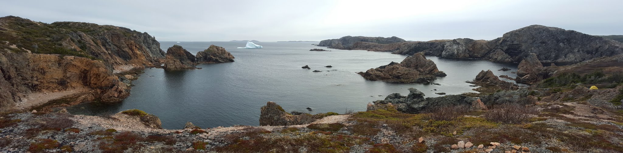
In early August we enjoyed 8 days on the beautiful East Coast Trail (ECT), a 312 km coastal hiking trail on the Avalon Peninsula of Newfoundland. It was a great combination of intense physical workout and beautiful nature scenes. If you plan on thru hiking or section hiking the ECT, check out the website ECT Thru Hike, this website has a ton of information such as transportation to/from trail, individual path distances, road walk distances (I hated walking those), etc. Also, the website has a really great Google Drive spreadsheet with a huge amount of data (i.e. water sources, campsites), I simply made it available offline to my phone and had access to it anytime. Below I tried to select 1 photo/video from each day. It may not be the "best" photo for that particular day, but I would consider it the most important. Enjoy!! Southern Trailhead: 46.861000, -52.944894  Classic ECT photo.
0 Comments
The Cape Blow Me Down Trail, formerly known as the Copper Mine Trail, and also as the Blow-Me-Down Mountain Trail is at the top of my list of favorite trails in Newfoundland with its combination of ocean and mountains. It is located on the West Coast of Newfoundland, about 45 minutes Southwest of Corner Brook and offers a nice mountain climbing experience (you climb up for 2 hrs, and then you climb down), no technical mountain climbing skills are required, and has great views of the beautiful Bay of Islands. Check out the pics below for more information.
Trailhead: 49.061819, -58.305261 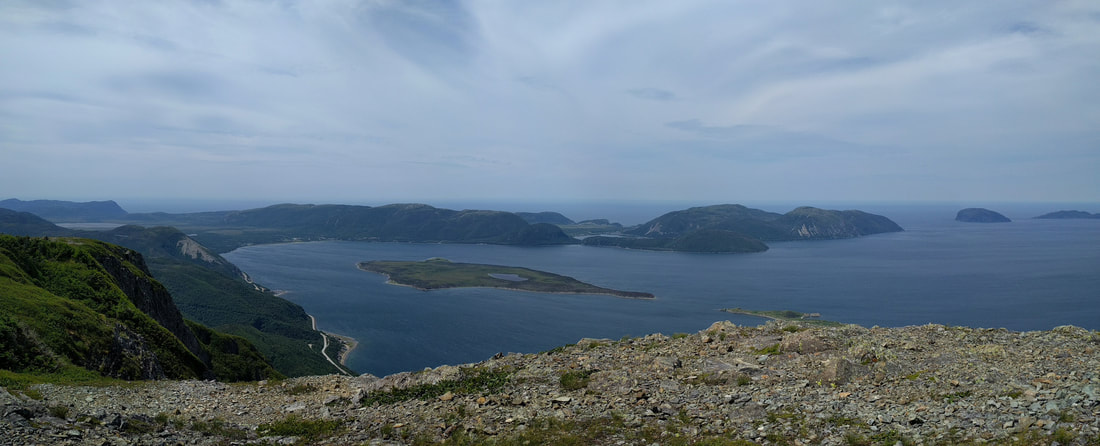
The Cape Blow Me Down Trail is a very "BCish" trail, mountains + ocean.
Twillingate, also known as the land of icebergs, has a great collection of short to medium length trails. One of my favourite ones to hike is the Spiller's Cove Trail which is located on the eastern part of the island.
Beautiful Spillers Cove Trail in Twillingate
The Avalon Peninsula of Newfoundland has some great coastal scenery; the major area it is lacking in is summit views. This all changed last night when we visited some friends at Butter Pot provincial park.
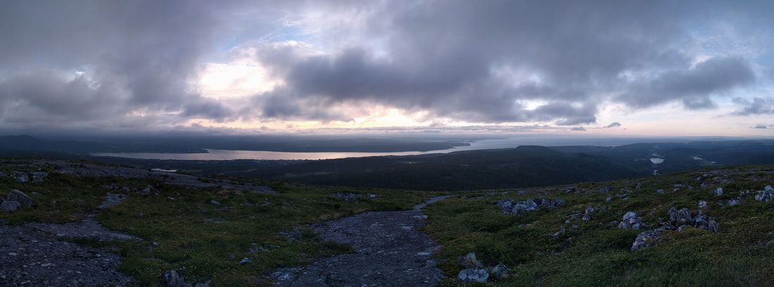
The summit view
Located about 50 km east of St. John's, this provincial park is well used by RV'ers but not so much by tenters. We were invited by friends to hike the trail and I had low expectations; was I ever wrong. It provided a good workout, the trail itself was in great shape, there were sections of bedrock to walk over, and it provided a great summit view of Conception Bay, and the central and Eastern parts of the Avalon. Check out the photos below, I am also including the trailhead coordinates because it is a bit difficult to find.
Trailhead: 47.39438, -53.06306
Summer has arrived and the Gout in my foot has finally subsided; time to get out and enjoy the East Coast Trail. Last weekend we were in the usual predicament of only having one vehicle, so we decided to do a "loop" walk. The path of choice for us was from Witless Bay to Mobile (also known as Beaches path) and returning on the pavement back to our vehicle. In total, it was a great 11.4 km of walking, and the views along the many rocky beaches were fantastic. Check out the pics, elevation profile, and interactive map below.
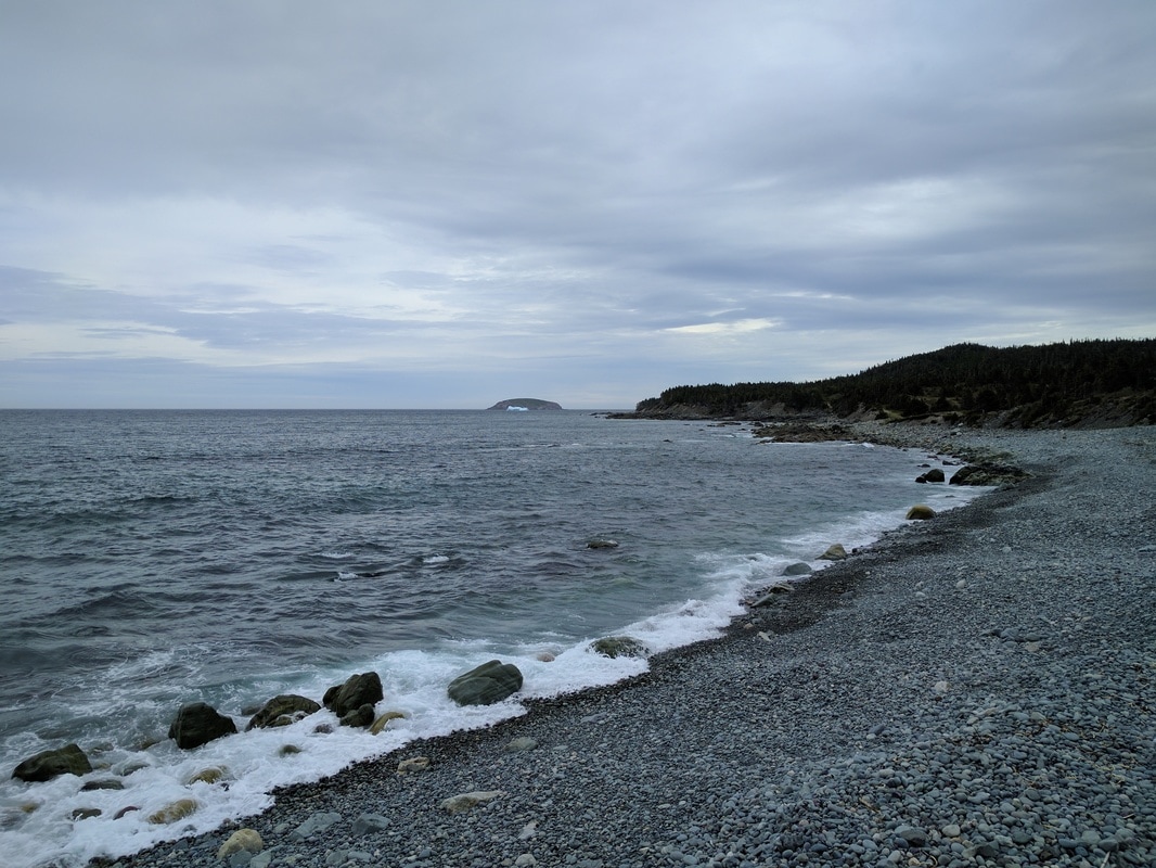
Near the start of the hike, with a beautiful iceberg in the distance and the rugged Ragged beach.
As you may know, I grew up on the West Coast of Newfoundland and for the first 35 years of my life, I never visited Gros Morne National Park. That all changed in the summer of 2014 when I first hiked Gros Morne Mountain. This year (2016) I did a repeat performance of Gros Morne Mountain, followed the next day by a relaxing boat tour in Western Brook Pond .
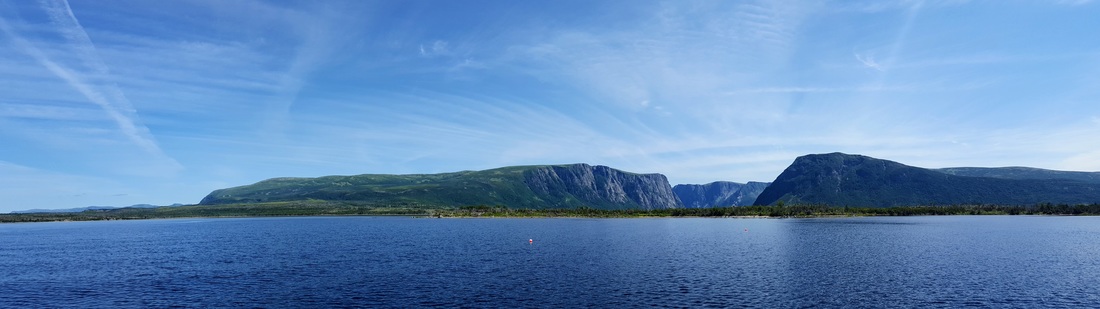
Western Brook Boat Tour happens straight up through the of this section of the Long Range Mountains.
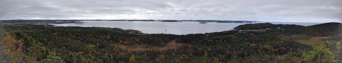
Over the Thanksgiving (Canadian) break this year we decided to visit family in Twillingate, Newfoundland. In anticipation of eating two Turkey Dinners (not a typo) I decided to go for a run on the Top of Twillingate Trail.
One of my favourite hiking trails to do on the Southwest Coast of Newfoundland is the Starlight Trail (named after the former Starlight Motel). The trail gives great views of the Long Range Mountains and Codroy Valley without a lot of effort with the total distance being less than 5 km and maximum elevation is about 350 m.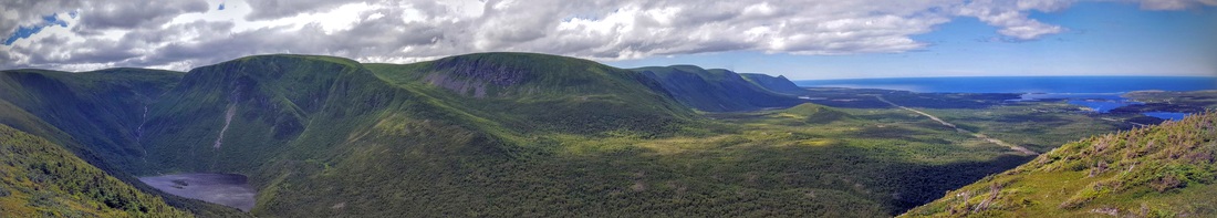
View of the Long Range Mountains and Codroy Valley from top of the Starlight Trail.
Realizing that the end of summer is very near :( led us to take a drive to Witless Bay for a short hike along the Beaches Path section of the East Coast Trail. Check out the photos below of this short, but wonderful hike.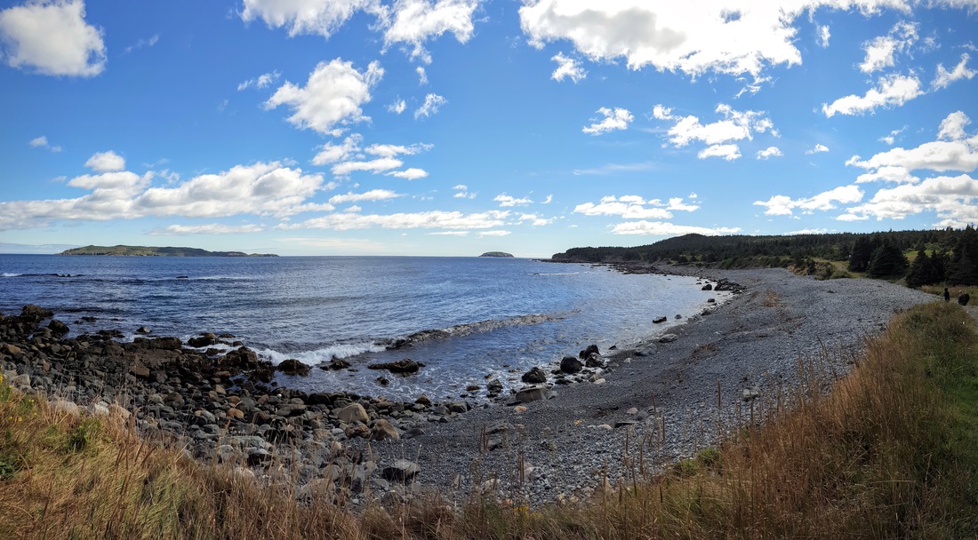
Beautiful times at Witless Bay.
Stumbling across this article in the Downhome Magazine lead to a 1 hour drive and 30 minute hike to relive some memories of walking across the La Manche Suspension bridge. Check out the pics below of this short but very enjoyable hike.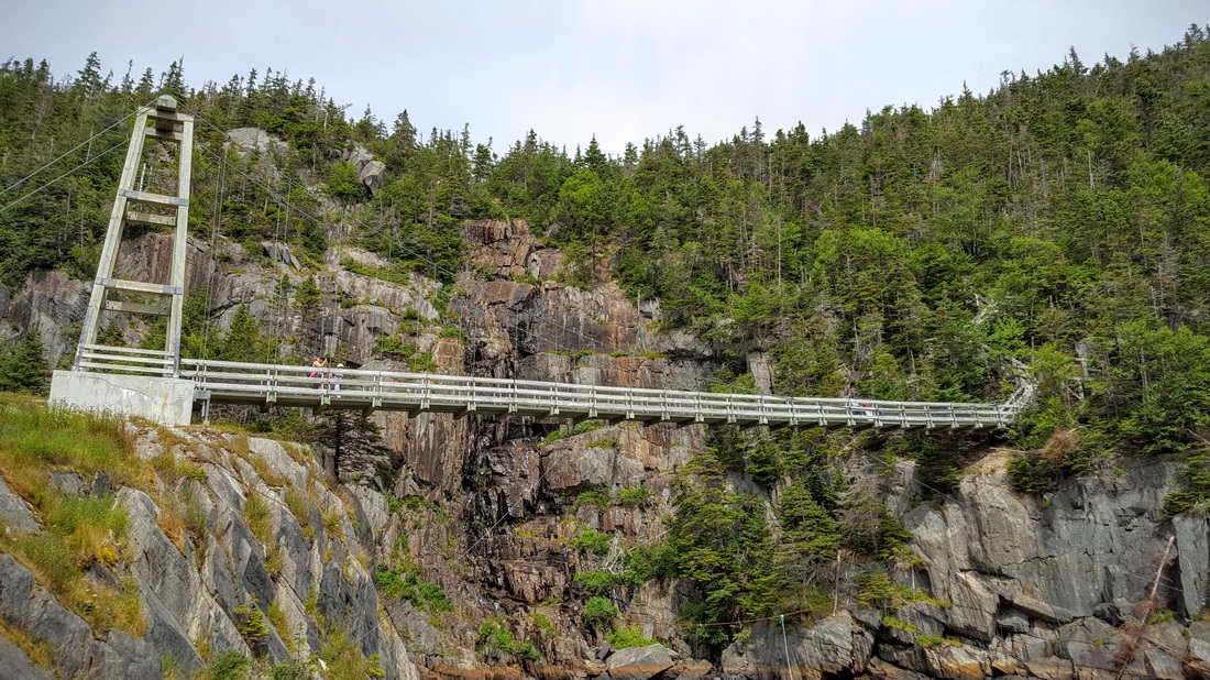
Newfoundland's only suspension bridge?
|
AuthorSheldon Huelin is a proud Newfoundlander and enjoys all things outside. Archives
July 2021
Categories
All
|
 RSS Feed
