|
If you visit the Great Northern Peninsula (GNP), make a point to see, and hopefully hike, Newfoundland's second highest point (806 m) - Gros Morne Mountain, which is located in Gros Morne National Park.
The drive up to Gros Morne mountain from Deer Lake has very little traffic the only thing that may slow you down is the typical summer construction or locals selling strawberries on the side of the road. The trailhead is easy to find, just look for a "trailhead-like" area on the same side of the road as Gros Morne mountain and has a washroom (kinda like an outhouse) and typical trailhead items such as maps and fancy signs.
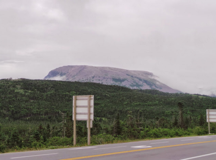
Gros Morne Mountain from Route 430 (viewing South)
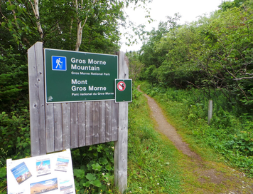
Signage near the trailhead.
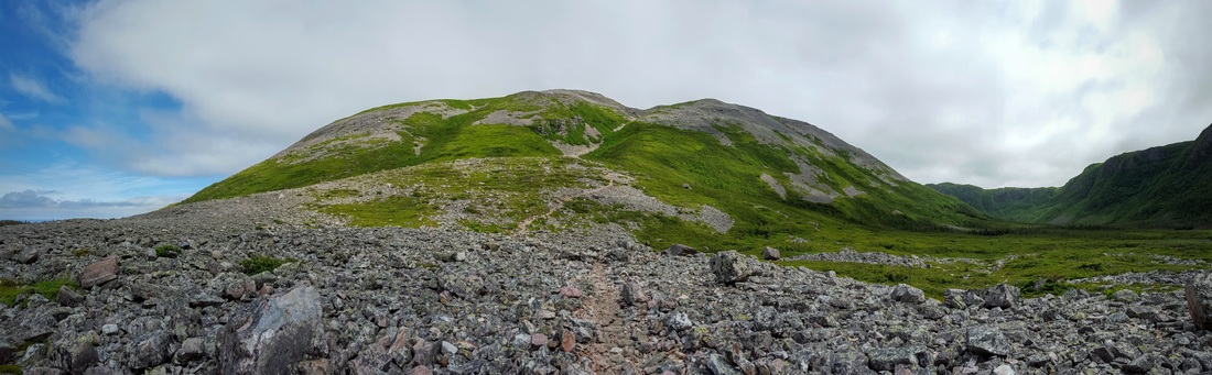
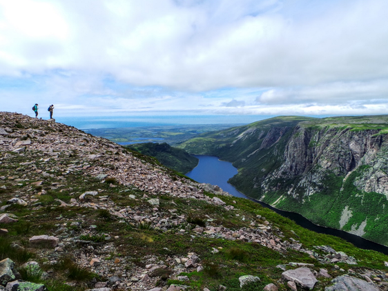
The first 1 km of the hike is mostly flat and is a little bit on the boring side. After that, the elevation climbs from about 50 m to 250 m over a distance of about 2 km and then this view appears:
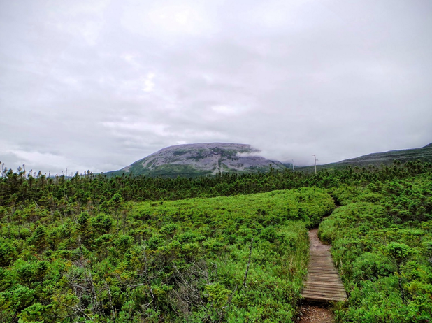
The first peak of Gros Morne mountain after 1 km of walking through woods.
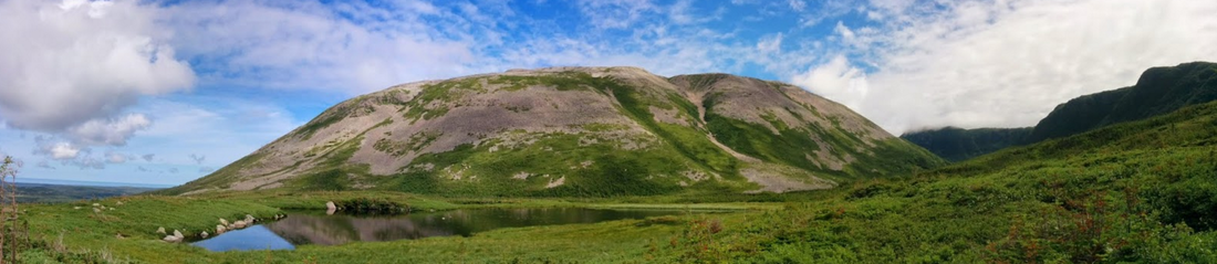
The beautiful base of Gros Morne mountain.
Next, prepare yourself for climbing the talus slope. I have done a lot of hiking in Newfoundland and this is one of the hardest sections of trail that I have done: it is steep, there is not much of a trail, and the rocks are very angular and somewhat loose; give yourself at least 1 hr to climb this.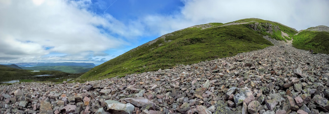
The Talus Slope (aka gorge) is about 1.3 km of walking over 50 cm - 100 cm chunks of granite.
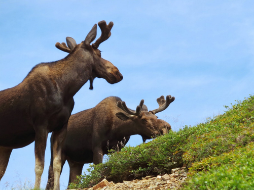
Up close and personal with Moose after climbing the talus slope.
Walking across the top of Gros Morne is mostly flat and this lasts for about 2 km. The summit, at a height of 806, is a great spot to eat lunch, and you will probably strike up a conversation with fellow hikers. Crowd numbers at the summit are moderate for Newfoundland standards, 10-12 people, quite low for mainland Canada standards.
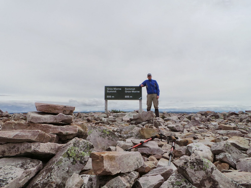
Summit time.
Friendly hikers from PEI with Ten Mile Pond in the background.
The first part (~1.5 km) of the descent from the summit (note that you cannot walk down the same way as you came up) is fairly easy, there is boardwalk and wooden steps present and the grade is low. After that the slope increases, wooden structures disappear, but views like this appear: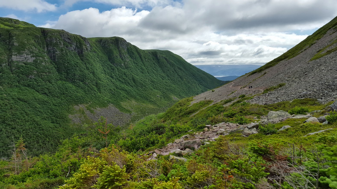
Descending Gros Morne Mountain.

Ferry Gulch, campsite is present on the far end of the pond and the Tablelands are in the background, what a view!
Eventually the descending stops and the scenic base area of Gros Morne mountain reappears. The trail out from the base is the same one as the trail in, it is mostly all downhill which is great for tired legs. Both times that I have hiked it I headed to Rocky Harbour for a meal of mooseburgers and fries at the Sunset Restaurant, they are fantastic! Update: Earl's Restaurant in Rocky Harbour also has fantastic moose burgers!!
How to get there: At Deer Lake, take Route 430 North for about 60 km until you see a huge knob of grey rock appear, that is Gros Morne Mountain. The trailhead is on the right (East) side of Route 430. Trailhead Coordinates: 49°33'56.6"N 57°49'55.5"W 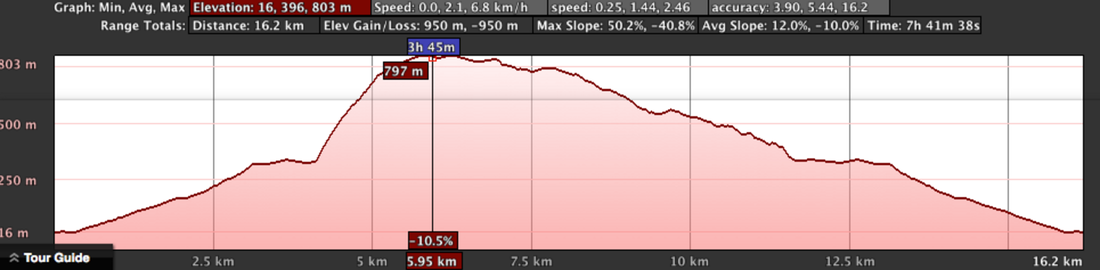
Track (kmz): Click here.
Hike Distance: 16 km. Elevation: 806 m, ascent is 790 m. Elevation Profile: Time to Complete: Anywhere from 5-10 hrs. Cellphone Coverage: The complete trail to the base of the mountain has coverage, it becomes very spotty during and after the kilometer 4. Helpful Tips:
2 Comments
10/22/2022 06:58:10 pm
Round up of all ✌ the latest DHgate discounts promotions and coupon codes ⭐ $150 Off Purchase Over $2000 DHgate Code ✓ Leave a Reply. |
AuthorSheldon Huelin is a proud Newfoundlander and enjoys all things outside. Archives
July 2021
Categories
All
|
 RSS Feed
