One of my favourite hiking trails to do on the Southwest Coast of Newfoundland is the Starlight Trail (named after the former Starlight Motel). The trail gives great views of the Long Range Mountains and Codroy Valley without a lot of effort with the total distance being less than 5 km and maximum elevation is about 350 m.
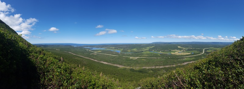
View of the Long Range Mountains and Codroy Valley from top of the Starlight Trail.
The trailhead to the Starlight Trail (aka Starlite Trail) is located about 25 minutes from Port-Aux-Basques and is the site of the former Starlight Motel. The first 5-10 minutes of hiking is mostly flat with some boardwalk and is somewhat marked. After that the trail becomes more rocky, the elevation starts to increase, and the trees become smaller and eventually disappear. The remainder of the trail is not marked, but the trail path is relatively easy to see.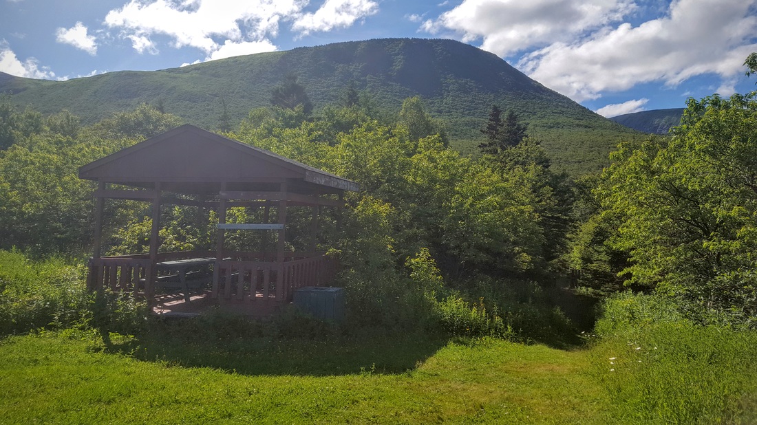 Starlight Trail trailhead. Starlight Trail trailhead.
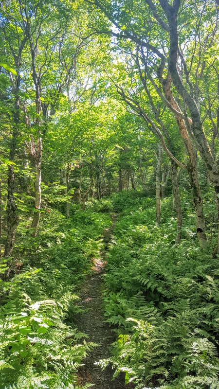
Gentle increase for the first 0.5 km or so.
The views will only get better.
TCH to the left, trail in the centre.
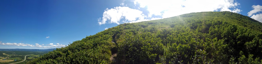
Once the steep part of the climb is over, a scenic lookout is present to the right of the main trail, and days of exploring the Long Range Mountains are to the left. Note that the IATNL has a 32 km section of trail called the Grand Codroy Way that goes from the Starlight Trail south along the Long Range Mountains.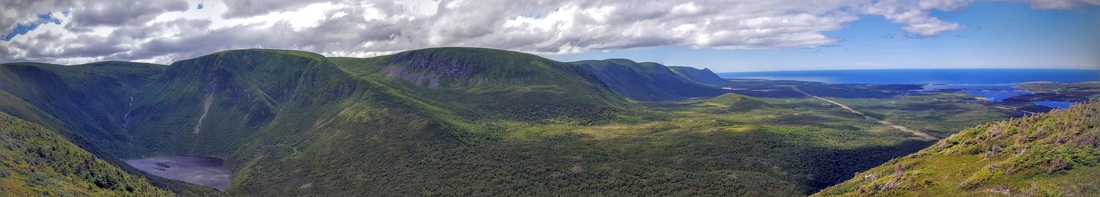
Beautiful scenic view looking South, long range mountains are to the left, Atlantic Ocean to the right.
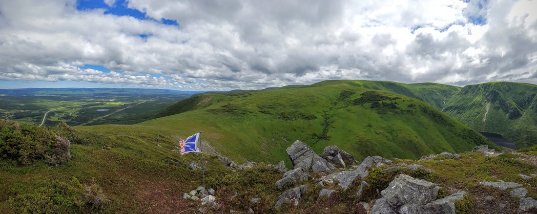
The Newfoundland flag makes an appearance.
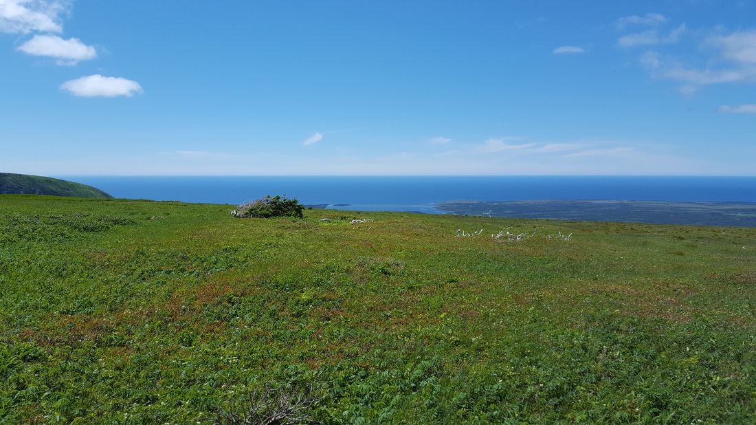
Venturing left at the trail intersection provides endless exploration along the Long Range Mountains. The hiking is of moderate difficulty, with grass as high as 4 ft long and occasional wet/boggy areas. ​During my last hike on the Starlight Trail I spent about 3-4 hrs exploring the mostly flat top part of the mountain, great views were found everywhere.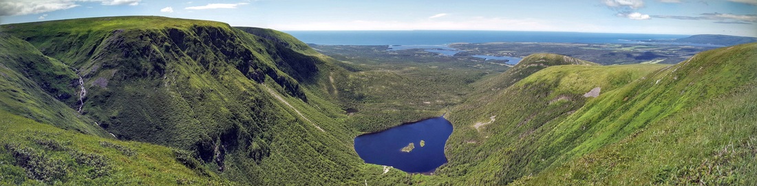
This is about 2 hrs hiking away from the scenic lookout (hill on the right in the background). Campbell's Lake is in the center, note that their is a trail going to this also.
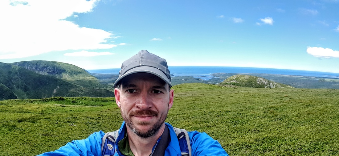
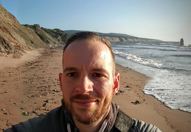
Selfie time!!
Life on top of the Long Range Mountains.

Moose on top of the Long Range Mountains.
How to get there: The trailhead is at the site of the former Starlight motel, which is about 25 km north of the town of Port-aux-basques along the TCH.
​Trail Head Coordinates: 47°46'56.5"N 59°13'56.7"W
Track (kmz): Click here.
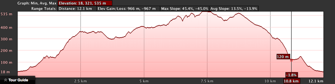
Elevation profile of the Starlight Trail. At the 2.5 km mark is the scenic lookout, the remainder is off the path exploring.
​Track Distance: Hike to the scenic lookout is 4.7 km; exploring the Long Range Mountains is about unlimited. Elevation: 350 m, ascent is about 330 m. Exploring the mountain areas can get up to ~600 m in elevation. Time to Complete: Hike to the scenic lookout is less than 4 hrs return. Cellphone Coverage: Yes. Helpful Tips:
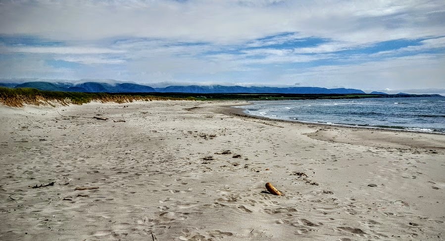
Searston beach with fog rolling over the Long Range mountains.
8 Comments
Arthur Andrews
12/28/2020 06:42:34 pm
Hi Sheldon, I am from the UK and have come across a guy called Felix Scully Starlight, who purported to come from Newfoundland and in 1922 set off to walk around the world, supposedly covering 100,000 miles plus. He ended up in the UK in 1931 with a view to returning to St Johns in 1933 to write a book about his travels. At first I wondered if the Starlight Trail may have been named after him, rather than a motel. He had a publicity postcard that he sold to help finance his travels. He ends up in my home town in 1933 and has a newspaper article written about him, including a photograph. Felix was supposed to be half Native Indian and half Irish. (Similar to the wild life conservationist, Grey Owl, allegedly half Apache and half Scottish but really from Hastings in England!) It would be great if you could help or put me in touch with maybe a local historian. I have been to Newfoundland a couple of times enjoying going to Joe Batts Arm, Fogo Island, Seldom and Seldom Come By. Loved the musical Come From Away as well in London a couple of years ago. Best wishes for 2021 in these uncertain Covid times, Arthur
Sheldon
1/5/2021 11:27:24 am
Hi Arthur;
Arthur Andrews
1/16/2021 08:11:50 am
Hi Sheldon, Thanks for your prompt reply. Hopefully, a reply will come from IATNL. Is there a local history group in St John's that I could make contact with? Best wishes, Arthur
Hi Sheldon, 2/22/2021 03:13:07 pm
Hi Kathryn;
Hi Sheldon, Thank you so much for your kind reply and for letting me use this great photo! I really appreciate it. I've never been to Newfoundland but have totally fallen in love with it as many people in my virtual choir live there and I'm really feeling the pull to visit now. The choir is Sing the North - https://singthenorth.ca
D Brooking
1/22/2022 10:04:05 pm
Hi there, looking to probably hike this trail in July of this year. Would you know if it is overgrown now or the trail still visible to travel ?
Jennifer
6/24/2022 10:36:17 am
Hi, the trail is still visible. I complete this trail 2 weeks ago. Bring lots of water and enjoy the spectacular view. Leave a Reply. |
AuthorSheldon Huelin is a proud Newfoundlander and enjoys all things outside. Archives
July 2021
Categories
All
|
 RSS Feed
